Support quality, independent, local journalism…that matters
From just £1 a month you can help fund our work – and use our website without adverts. Become a member today

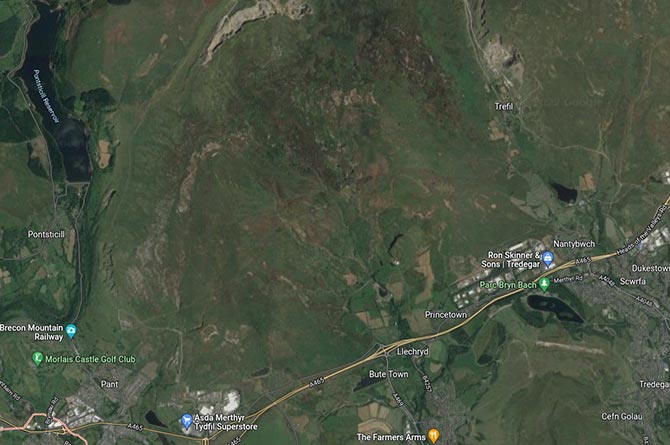
Plans for a wind farm near Rhymney have been officially submitted.
The proposals, from RWE Renewables UK Limited, would see up to six turbines on land to the north of the A465 Heads of the Valleys Road.
The application will be made to the Welsh Government by submitting an application to Planning Environment Decisions Wales (PEDW).
The proposed scheme will be classed as a Development of National Significance (DNS) as the wind turbines will have a combined installed capacity of greater than ten megawatts (MW).
What is a Development of National Significance?
A Development of National Significance (DNS) is a type of planning application for a large infrastructure project of national importance – for example, a wind farm, power station or reservoir.
A DNS differs from a normal planning application in the way that it is decided. Instead of your Local Planning Authority making the decision, an Inspector examines the application and makes a recommendation to the Welsh Minister based on planning merits and national priorities. The Minister then decides whether or not to grant permission.
Any proposal to build or operate a power generation scheme with a capacity greater than ten MW falls within the DNS system and requires consent from Welsh Government ministers, as well as a design and access statement submitted with the application.
The statement said the proposed scheme includes the construction of up to six wind turbines, with a maximum blade tip height of up to 180m.
The majority of the development site is registered as common land and makes up part of Gelligaer and Merthyr Common. This means there will also be an application for consent to de-register and offer exchange common land and consent to carry out restricted works on common land with an environmental statement also being submitted.
The site covers an area of approximately 459.9 hectares and has Bannau Brycheiniog National Park to the north, Nant Tor-gwyn to the west, Nant Pitwellt to the east, and the Common Road to the south.
The design and access statement said the site comprises a broadly sloping area of purple moor grass-dominated grassland, with small, scattered areas of dense scrub, exposed rock, dry heath and standing open water habitats.
The wider landscape around the site includes grazed moorland habitats with areas of industrial and residential development to the south, south-east and south-west of the site.
The majority of the site is within both Caerphilly County Borough and Merthyr Tydfil County Borough.
The design and access statement said the project would deliver renewable energy to the national energy grid and would contribute to meeting national climate change targets.
It said it would also provide opportunities for community investment and create further employment opportunities in the local area.
The report also states the site was suitable for the construction and operation of a wind farm development without significant technical or environmental constraints.
The statement said: “Consultation of key consultees and the public was also undertaken to provide an opportunity for them to raise any issues or concerns that might influence the design of the development” and that the consideration of environmental aspects during design has enabled many potential environmental impacts to be mitigated.
It added that access to the site during construction will be carefully managed to ensure minimal disruption to members of the public and commoners/grazers using the common land – and that impact on road users and local communities around the site will be managed during construction via a construction traffic management plan.
When it’s up and running, access to the site will be “largely unimpeded” apart from access to the land on which the electricity and battery storage facilities and the wind turbines themselves are situated, the statement said.
It also said that the site will be more easily accessible for grazers/commoners using the wind farm access track network and there will be replacement land for the land that’s been used for the wind farm.
Support quality, independent, local journalism…that matters
From just £1 a month you can help fund our work – and use our website without adverts.
Become a member today