Support quality, independent, local journalism…that matters
From just £1 a month you can help fund our work – and use our website without adverts. Become a member today
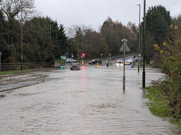
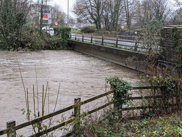
Storm Bert has brought flooding to areas across Caerphilly County Borough with several warnings from Natural Resources Wales still in place.
A Met Office warning for heavy rain was in force across Wales until 1pm Sunday.
Natural Resources Wales had a total of ten flood warnings for the Caerphilly County Borough Council area.
These are:
- River Rhymney at Dyffryn Industrial Estate
- River Rhymney at Machen
- Ebbw Fach at Aberbeeg
- River Ebbw at Llanhilleth
- River Rhymney at Caerphilly
- River Rhymney at Bedwas
- River Rhymney at Llanbradach
- River Rhymney at Bedwas House Industrial Estate
- River Rhymney at Ystrad Mynach
- River Ebbw at Risca
Gwent Police has advised people to only travel if essential.
A spokesperson said: “We are managing flooding across Gwent, working alongside the South Wales Fire and Rescue Service, local councils, the Met Office, Wales Ambulance Service and Natural Resource Wales.”
Andy Page is a Met Office Chief Meteorologist and said: “Impacts from Storm Bert will continue to cause disruption as we go through today, and multiple warnings are in place for wind and rain.
“While the risk of any snowfall has now diminished, rainfall will affect much of the UK today, in particular some southwestern parts of England and South Wales, but the heaviest rain will ease from these areas through the day.
“The strong southerly winds continue today and warnings are in place for central, southern and eastern England, Northern Ireland and western Scotland where gusts could peak at 60 mph and could even reach more than 70 mph along some exposed coasts.
“Warnings could still be amended, possibly at short notice, so it is important people keep up to date with the very latest forecast.”


Further ahead
According to the Met Office, Storm Bert will finally clear form the far northeast early on Tuesday. Next week will bring quieter weather for many, although there is a risk of some further rain and strong winds across the south of the UK on Tuesday night and Wednesday.
Looking further ahead, there are indications we could see a brief return to colder conditions although for many, but it will be drier than of late. How long the more settled conditions last is uncertain, with rain probably returning to westernmost areas at least by the end of the week.
Support quality, independent, local journalism…that matters
From just £1 a month you can help fund our work – and use our website without adverts.
Become a member today