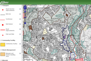
Caerphilly County Borough Council has launched an online interactive version of its Local Development Plan (LDP), which is its blueprint to guide future development.
In November 2010, the council was the first local authority in Wales to adopt its LDP setting out the its policies and proposals to control land use up until 2021.
It has now launched a version of the LDP online to allow visitors to search a map and find out about land use proposals in their area.
Councillor Ron Davies, cabinet member for regeneration and planning said: “Caerphilly has been at the forefront in Wales in driving forward the development of its LDP. It’s great to see that we are once again using innovation to inform residents about these important planning issues in a new interactive format. I’d like to thank the team involved for their efforts in bringing this scheme to fruition.”
Click here to view Caerphilly County Borough Council’s online Local Development Plan.

Sad to see that on the map The Warran (sic) is mis-spelt and that the SSSI around the former Clay Pits in Caerphilly is not marked.
Are there moves to change the name and to remove the SSSI from protection?